Eritrea
State of Eritrea
Updated
Population
3.61 million
2025 · World Bank
GDP
$2.07B
2011 · World Bank
GDP per capita
$689
2011 · World Bank
Area
117,600 km²
mledoze/countries reference dataset
Capital
Asmara
Median age
19.2 yrs
2025 · UN WPP
Location
- Capital
- Asmara
- Region
- Africa
- Subregion
- Eastern Africa
- Area
- 117,600 km²
- Neighbours
- 3
- Languages
- Arabic, English, Tigrinya
Leadership
- Head of state
- Isaias Afwerki
- In office since January 1, 1993
Wikidata (CC0), checked August 11, 2026. Frozen Factbook mirrors still list the officeholders of January 2026.
Then and now
The CIA World Factbook stopped updating in January 2026. This is what has changed since its final edition.
| Indicator | Factbook, final edition | Current | Change |
|---|---|---|---|
| Population | 6,416,4352025 | 3,607,0032025 | -43.8% |
Trends since 2000
World Bank, World Development Indicators (CC BY 4.0).
6 facts about Eritrea
- 01 Eritrea ranks 131 of 238 in population, with 3.61 million people as of 2025.
- 02 Its economy produced $2.07B in 2011, or $689 per person.
- 03 It shares land borders with 3 neighbours: Djibouti, Ethiopia, Sudan.
- 04 Population has grown 61% since 2000, from 2.25 million to 3.61 million.
- 05 14% of the population uses the internet (2020).
- 06 It lists 3 official or major languages: Arabic, English, Tigrinya.
Reference
- Languages
- Arabic, English, Tigrinya
- Currency
- Eritrean nakfa (ERN)
- Calling code
- +291
- Internet TLD
- .er
- Demonym
- Eritrean
- ISO codes
- ER · ERI · 232
Compare Eritrea
The Factbook archive 128 fields · 11 categories
The complete World Factbook entry for Eritrea: 128 fields and 197 sub-entries across 11 categories, kept whole as historical reference. A United States Government work in the public domain, reflecting data as of the final January 2026 edition; the live figures above supersede the fast-moving numbers in it. Last CIA update: January 20, 2026.
Introduction 1 field
- Background
- Eritrea won independence from Italian colonial control in 1941, but the UN only established it as an autonomous region within the Ethiopian federation in 1952, after a decade of British administrative control. Ethiopia's full annexation of Eritrea as a province 10 years later sparked a violent 30-year conflict for independence that ended in 1991 with Eritrean fighters defeating government forces. Eritreans overwhelmingly approved independence in a 1993 referendum. ISAIAS Afwerki has been Eritrea's only president since independence; his rule, particularly since 2001, has been characterized by highly autocratic and repressive actions. His government has created a highly militarized society by instituting an unpopular program of mandatory conscription into national service -- divided between military and civilian service -- of indefinite length.
A two-and-a-half-year border war with Ethiopia that erupted in 1998 ended under UN auspices in 2000. Ethiopia rejected a subsequent 2007 Eritrea-Ethiopia Boundary Commission (EEBC) demarcation. More than a decade of a tense “no peace, no war” stalemate ended in 2018 when the newly elected Ethiopian prime minister accepted the EEBC’s 2007 ruling, and the two countries signed declarations of peace and friendship. Eritrean leaders then engaged in intensive diplomacy around the Horn of Africa, bolstering regional peace, security, and cooperation, as well as brokering rapprochements between governments and opposition groups. In 2018, the UN Security Council lifted an arms embargo that had been imposed on Eritrea since 2009, after the UN Somalia-Eritrea Monitoring Group reported they had not found evidence of Eritrean support in recent years for al-Shabaab. The country’s rapprochement with Ethiopia led to a resumption of economic ties, but the level of air transport, trade, and tourism have remained roughly the same since late 2020.
The Eritrean economy remains agriculture-dependent, and the country is still one of Africa’s poorest nations. Eritrea faced new international condemnation and US sanctions in mid-2021 for its participation in the war in Ethiopia’s Tigray Regional State, where Eritrean forces were found to have committed war crimes and crimes against humanity. As most Eritrean troops were departing northern Ethiopia in January 2023, ISAIAS began a series of diplomatic engagements aimed at bolstering Eritrea’s foreign partnerships and regional influence. Despite the country's improved relations with its neighbors, ISAIAS has not let up on repression, and conscription and militarization continue.
Geography 17 fields
- Location
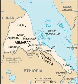
- Eastern Africa, bordering the Red Sea, between Djibouti and Sudan
- Geographic coordinates
- 15 00 N, 39 00 E
- Map references
- Africa
- Area
- total: 117,600 sq kmland: 101,000 sq kmwater: 16,600 sq km
- Area - comparative
- slightly smaller than Pennsylvania
- Land boundaries
- total: 1,840 kmborder countries: Djibouti 125 km; Ethiopia 1,033 km; Sudan 682 km
- Coastline
- 2,234 km (mainland on Red Sea 1,151 km; islands in Red Sea 1,083 km)
- Maritime claims
- territorial sea: 12 nm
- Climate
- hot, dry desert strip along Red Sea coast; cooler and wetter in the central highlands (up to 61 cm of rainfall annually, heaviest June to September); semiarid in western hills and lowlands
- Terrain
- dominated by extension of Ethiopian north-south trending highlands, descending on the east to a coastal desert plain, on the northwest to hilly terrain and on the southwest to flat-to-rolling plains
- Elevation
- highest point: Soira 3,018 mlowest point: near Kulul within the Danakil Depression -75 mmean elevation: 853 m
- Natural resources
- gold, potash, zinc, copper, salt, possibly oil and natural gas, fish
- Land use
- agricultural land: 62.7% (2023 est.)agricultural land: arable land: arable land: 5.7% (2023 est.)agricultural land: permanent crops: permanent crops: 0% (2023 est.)agricultural land: permanent pasture: permanent pasture: 56.9% (2023 est.)forest: 12% (2023 est.)other: 25.3% (2023 est.)
- Irrigated land
- 210 sq km (2012)
- Population distribution
- density is highest in the center of the country, in and around the cities of Asmara (capital) and Keren; smaller settlements exist in the north and south, as shown in this population distribution map
- Natural hazards
- frequent droughts, rare earthquakes and volcanoes; locust swarms
volcanism: Dubbi (1,625 m), which last erupted in 1861, was the country's only historically active volcano until Nabro (2,218 m) came to life in 2011 - Geography - note
- strategic geopolitical position along world's busiest shipping lanes
People and Society 29 fields
- Population
- total: 6,416,435 (2025 est.)male: 3,158,281female: 3,258,154
- Nationality
- noun: Eritrean(s)adjective: Eritrean
- Ethnic groups
- Tigrinya 50%, Tigre 30%, Saho 4%, Afar 4%, Kunama 4%, Bilen 3%, Hedareb/Beja 2%, Nara 2%, Rashaida 1% (2021 est.)
note: data represent Eritrea's nine recognized ethnic groups - Languages
- Tigrinya (official), Arabic (official), English (official), Tigre, Kunama, Afar, other Cushitic languages
- Religions
- Eritrean Orthodox, Roman Catholic, Evangelical Lutheran, Sunni Muslim
- Age structure
- 0-14 years: 35.7% (male 1,138,382/female 1,123,925)15-64 years: 60.3% (male 1,882,547/female 1,944,266)65 years and over: 4% (2024 est.) (male 101,504/female 153,332)
- Dependency ratios
- total dependency ratio: 64.2 (2025 est.)youth dependency ratio: 57.6 (2025 est.)elderly dependency ratio: 6.6 (2025 est.)potential support ratio: 15.1 (2025 est.)
- Median age
- total: 21.7 years (2025 est.)male: 20.8 yearsfemale: 21.8 years
- Population growth rate
- 1.16% (2025 est.)
- Birth rate
- 25.92 births/1,000 population (2025 est.)
- Death rate
- 6.43 deaths/1,000 population (2025 est.)
- Net migration rate
- -7.95 migrant(s)/1,000 population (2025 est.)
- Population distribution
- density is highest in the center of the country, in and around the cities of Asmara (capital) and Keren; smaller settlements exist in the north and south, as shown in this population distribution map
- Urbanization
- urban population: 43.3% of total population (2023)rate of urbanization: 3.67% annual rate of change (2020-25 est.)
- Major urban areas - population
- 1.073 million ASMARA (capital) (2023)
- Sex ratio
- at birth: 1.03 male(s)/female0-14 years: 1.01 male(s)/female15-64 years: 0.97 male(s)/female65 years and over: 0.66 male(s)/femaletotal population: 0.97 male(s)/female (2024 est.)
- Mother's mean age at first birth
- 21.3 years (2010 est.)
note: data represents median age at first birth among women 25-29 - Maternal mortality ratio
- 291 deaths/100,000 live births (2023 est.)
- Infant mortality rate
- total: 39 deaths/1,000 live births (2025 est.)male: 46.6 deaths/1,000 live birthsfemale: 32.8 deaths/1,000 live births
- Life expectancy at birth
- total population: 67.5 years (2024 est.)male: 64.9 yearsfemale: 70.2 years
- Total fertility rate
- 3.35 children born/woman (2025 est.)
- Gross reproduction rate
- 1.65 (2025 est.)
- Health expenditure
- Health expenditure (as % of GDP): 4.2% of GDP (2021)Health expenditure (as % of national budget): 2.4% of national budget (2022 est.)
- Physician density
- 0.09 physicians/1,000 population (2022)
- Hospital bed density
- 1 beds/1,000 population (2020 est.)
- Obesity - adult prevalence rate
- 5% (2016)
- Alcohol consumption per capita
- total: 0.93 liters of pure alcohol (2019 est.)beer: 0.42 liters of pure alcohol (2019 est.)wine: 0 liters of pure alcohol (2019 est.)spirits: 0 liters of pure alcohol (2019 est.)other alcohols: 0.51 liters of pure alcohol (2019 est.)
- Tobacco use
- total: 7.5% (2020 est.)male: 14.7% (2020 est.)female: 0.2% (2020 est.)
- School life expectancy (primary to tertiary education)
- total: 8 years (2015 est.)male: 9 years (2015 est.)female: 7 years (2015 est.)
Environment 11 fields
- Environmental issues
- deforestation; desertification; soil erosion; overgrazing
- International environmental agreements
- party to: Biodiversity, Climate Change, Climate Change-Kyoto Protocol, Comprehensive Nuclear Test Ban, Desertification, Endangered Species, Hazardous Wastes, Ozone Layer Protection, Whalingsigned, but not ratified: Climate Change-Paris Agreement
- Climate
- hot, dry desert strip along Red Sea coast; cooler and wetter in the central highlands (up to 61 cm of rainfall annually, heaviest June to September); semiarid in western hills and lowlands
- Land use
- agricultural land: 62.7% (2023 est.)agricultural land: arable land: arable land: 5.7% (2023 est.)agricultural land: permanent crops: permanent crops: 0% (2023 est.)agricultural land: permanent pasture: permanent pasture: 56.9% (2023 est.)forest: 12% (2023 est.)other: 25.3% (2023 est.)
- Urbanization
- urban population: 43.3% of total population (2023)rate of urbanization: 3.67% annual rate of change (2020-25 est.)
- Carbon dioxide emissions
- total emissions: 733,000 metric tonnes of CO2 (2023 est.)from petroleum and other liquids: 733,000 metric tonnes of CO2 (2023 est.)
- Particulate matter emissions
- 22.7 micrograms per cubic meter (2019 est.)
- Methane emissions
- energy: 15.7 kt (2022-2024 est.)agriculture: 117.4 kt (2019-2021 est.)waste: 20.5 kt (2019-2021 est.)other: 2.8 kt (2019-2021 est.)
- Waste and recycling
- municipal solid waste generated annually: 727,000 tons (2024 est.)percent of municipal solid waste recycled: 6.8% (2022 est.)
- Total water withdrawal
- municipal: 31 million cubic meters (2022 est.)industrial: 1 million cubic meters (2022 est.)agricultural: 550 million cubic meters (2022 est.)
- Total renewable water resources
- 7.315 billion cubic meters (2022 est.)
Government 24 fields
- Country name
- conventional long form: State of Eritreaconventional short form: Eritrealocal long form: Hagere Ertralocal short form: Ertraformer: Eritrea Autonomous Region in Ethiopiaetymology: the country name derives from the ancient Greek name Erythra Thalassa, meaning "Red Sea," the body of water that borders the country
- Government type
- authoritarian
- Capital
- name: Asmarageographic coordinates: 15 20 N, 38 56 Etime difference: UTC+3 (8 hours ahead of Washington, DC, during Standard Time)etymology: the name's origin is unclear; according to Tigrinya oral tradition, the name is part of a phrase meaning "the women made them unite," referring to a group of women who made four clans unite to defeat a common enemy; asmara also means "flowery wood" in the Tigrinya language
- Administrative divisions
- 6 regions (zobatat, singular - zoba); 'Anseba, Debub (South), Debubawi K'eyyih Bahri (Southern Red Sea), Gash-Barka, Ma'ikel (Central), Semienawi K'eyyih Bahri (Northern Red Sea)
- Legal system
- mixed system of civil, customary, and Islamic religious law
- Constitution
- history: ratified by the Constituent Assembly 23 May 1997 (never implemented)amendment process: proposed by the president of Eritrea or by assent of at least one half of the National Assembly membership; passage requires at least an initial three-quarters majority vote by the Assembly and, after one year, final passage by at least four-fifths majority vote by the Assembly
- International law organization participation
- has not submitted an ICJ jurisdiction declaration; non-party state to the ICCt
- Citizenship
- citizenship by birth: nocitizenship by descent only: at least one parent must be a citizen of Eritreadual citizenship recognized: noresidency requirement for naturalization: 20 years
- Suffrage
- 18 years of age; universal
- Executive branch
- chief of state: President ISAIAS Afwerki (since 24 May 1993)head of government: President ISAIAS Afwerki (since 8 June 1993)cabinet: State Council appointed by the presidentelection/appointment process: president indirectly elected by the National Assembly for a 5-year term (eligible for a second term), according to the constitutionmost recent election date: 24 May 1993, following independence from Ethiopiaelection results:
1993: ISAIAS Afwerki elected president by the transitional National Assembly; percent of National Assembly vote - ISAIAS Afwerki (PFDJ) 95%, other 5%expected date of next election: postponed indefinitely - Legislative branch
- legislature name: National Assembly (Hagerawi Baito)legislative structure: unicameralnumber of seats: 150 (all indirectly elected)scope of elections: full renewalterm in office: 4 yearsmost recent election date: 2/1/1994
- Judicial branch
- highest court(s): High Court (consists of 20 judges and organized into civil, commercial, criminal, labor, administrative, and customary sections)judge selection and term of office: High Court judges appointed by the presidentsubordinate courts: regional/zonal courts; community courts; special courts; sharia courts (for issues dealing with Muslim marriage, inheritance, and family); military courts
- Political parties
- People's Front for Democracy and Justice or PFDJ (the only party recognized by the government)
- Diplomatic representation in the US
- chief of mission: Ambassador (vacant); Chargé d'Affaires Berhane Gebrehiwet SOLOMON (since 15 March 2011)chancery: 1708 New Hampshire Avenue NW, Washington, DC 20009telephone: [1] (202) 319-1991FAX: [1] (202) 319-1304email address and website:
[email protected]
https://us.embassyeritrea.org/ - Diplomatic representation from the US
- chief of mission: Ambassador (vacant); Chargé d'Affaires Christine E. MEYER (since July 2025)embassy: 179 Alaa Street, Asmaramailing address: 7170 Asmara Place, Washington DC 20521-7170telephone: [291] (1) 12-00-04FAX: [291] (1) 12-75-84email address and website:
[email protected]
https://er.usembassy.gov/ - International organization participation
- ACP, AfDB, AU, COMESA, FAO, G-77, IAEA, IBRD, ICAO, ICC (NGOs), IDA, IFAD, IFC, IFRCS (observer), IGAD, ILO, IMF, IMO, Interpol, IOC, ISO (correspondent), ITU, ITUC (NGOs), LAS (observer), MIGA, NAM, OPCW, PCA, UN, UNCTAD, UNESCO, UNHRC, UNIDO, UNWTO, UPU, WCO, WFTU (NGOs), WHO, WIPO, WMO
- Independence
- 24 May 1993 (from Ethiopia)
- National holiday
- Independence Day, 24 May (1991)
- Flag
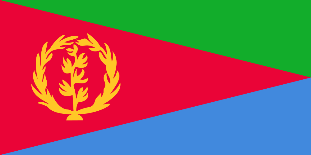
- description: a red isosceles triangle (based on the left side) divides the flag into two right triangles; the upper triangle is green, the lower is blue; a gold wreath around a gold olive branch is on the left side of the red triangle
meaning: green stands for the country's agriculture economy, red for the blood shed in the fight for freedom, and blue for the sea's bounty; the shape of the red triangle mimics the country's shape
note: one of four national flags that reflect the country's shape in the flag design; the others are Bosnia and Herzegovina, Brazil, and Vanuatu - National symbol(s)
- camel
- National color(s)
- green, red, blue
- National coat of arms
- Eritrea adopted its coat of arms on May 24, 1993, when it won independence from Ethiopia; the camel was used to transport supplies and goods during the war, and it became a symbol of the country’s success; the olive wreath represents peace, reconciliation, and harmony; under the camel is name of the country in its three official languages: Tigrinya, English, and Arabic
- National anthem(s)
- title: "Ertra, Ertra, Ertra" (Eritrea, Eritrea, Eritrea)lyrics/music: SOLOMON Tsehaye Beraki/Isaac Abraham MEHAREZGI and ARON Tekle Tesfatsionhistory: adopted 1993, after gaining independence from Ethiopia
- National heritage
- total World Heritage Sites: 1 (cultural)selected World Heritage Site locales: Asmara: A Modernist African City
Economy 22 fields
- Economic overview
- largely agrarian economy with a significant mining sector; substantial fiscal surplus due to tight controls; high and vulnerable debts; increased Ethiopian trade and shared port usage decreasing prices; financial and economic data integrity challenges
- Real GDP (purchasing power parity)
- Real GDP (purchasing power parity) 2024: $2.534 billion (2024 est.)Real GDP (purchasing power parity) 2023: $2.465 billion (2023 est.)Real GDP (purchasing power parity) 2022: $2.398 billion (2022 est.)
- Real GDP growth rate
- Real GDP growth rate 2017: 5% (2017 est.)Real GDP growth rate 2016: 1.9% (2016 est.)Real GDP growth rate 2015: 2.6% (2015 est.)
- Real GDP per capita
- Real GDP per capita 2024: $700 (2024 est.)Real GDP per capita 2023: $700 (2023 est.)Real GDP per capita 2022: $700 (2022 est.)
- GDP (official exchange rate)
- $2.535 billion (2024 est.)
note: data in current dollars at official exchange rate - Inflation rate (consumer prices)
- Inflation rate (consumer prices) 2022: 7.4% (2022 est.)Inflation rate (consumer prices) 2021: 6.6% (2021 est.)Inflation rate (consumer prices) 2020: 5.6% (2020 est.)
- Agricultural products
- sorghum, milk, barley, vegetables, root vegetables, cereals, pulses, wheat, beef, maize (2023)
note: top ten agricultural products based on tonnage - Industries
- food processing, beverages, clothing and textiles, light manufacturing, salt, cement
- Labor force
- 1.71 million (2024 est.)
note: number of people ages 15 or older who are employed or seeking work - Unemployment rate
- Unemployment rate 2024: 5.6% (2024 est.)Unemployment rate 2023: 5.6% (2023 est.)Unemployment rate 2022: 5.7% (2022 est.)
- Youth unemployment rate (ages 15-24)
- total: 9.4% (2024 est.)male: 8.5% (2024 est.)female: 10.5% (2024 est.)
- Budget
- revenues: $633 million (2018 est.)expenditures: $549 million (2018 est.)
- Public debt
- Public debt 2016: 132.8% of GDP (2016 est.)
- Exports
- Exports 2017: $624.3 million (2017 est.)Exports 2016: $485.4 million (2016 est.)Exports 2011: $374.898 million (2011 est.)
- Exports - partners
- China 67%, UAE 26%, Philippines 5%, Italy 1%, Croatia 1% (2023)
note: top five export partners based on percentage share of exports - Exports - commodities
- copper ore, zinc ore, gold, garments, liquor (2023)
note: top five export commodities based on value in dollars - Imports
- Imports 2010: $494.229 million (2010 est.)Imports 2009: $435.275 million (2009 est.)
- Imports - partners
- China 32%, UAE 27%, Turkey 9%, USA 7%, Italy 5% (2023)
note: top five import partners based on percentage share of imports - Imports - commodities
- trucks, sorghum, construction vehicles, wheat flours, other foods (2023)
note: top five import commodities based on value in dollars - Reserves of foreign exchange and gold
- Reserves of foreign exchange and gold 2019: $191.694 million (2019 est.)Reserves of foreign exchange and gold 2018: $163.034 million (2018 est.)Reserves of foreign exchange and gold 2017: $143.412 million (2017 est.)
- Debt - external
- Debt - external 2023: $461.376 million (2023 est.)
- Exchange rates
- Currency: nakfa (ERN) per US dollar -Exchange rates 2024: 15.075 (2024 est.)Exchange rates 2023: 15.075 (2023 est.)Exchange rates 2022: 15.075 (2022 est.)Exchange rates 2021: 15.075 (2021 est.)Exchange rates 2020: 15.075 (2020 est.)
Energy 5 fields
- Electricity access
- electrification - total population: 55.4% (2022 est.)electrification - urban areas: 75.5%electrification - rural areas: 36%
- Electricity
- installed generating capacity: 243,000 kW (2023 est.)consumption: 388.987 million kWh (2023 est.)transmission/distribution losses: 51.528 million kWh (2023 est.)
- Electricity generation sources
- fossil fuels: 89.1% of total installed capacity (2023 est.)solar: 10.7% of total installed capacity (2023 est.)wind: 0.2% of total installed capacity (2023 est.)
- Petroleum
- refined petroleum consumption: 5,000 bbl/day (2023 est.)
- Energy consumption per capita
- Total energy consumption per capita 2023: 2.977 million Btu/person (2023 est.)
Communications 6 fields
- Telephones - fixed lines
- total subscriptions: 68,200 (2022 est.)subscriptions per 100 inhabitants: 2 (2022 est.)
- Telephones - mobile cellular
- total subscriptions: 2.02 million (2022 est.)subscriptions per 100 inhabitants: 59 (2022 est.)
- Broadcast media
- government controls broadcast media, with private ownership prohibited; 1 state-owned TV station; 2 state-owned radio networks; purchases of satellite dishes and subscriptions to international broadcast media are permitted (2023)
- Internet country code
- .er
- Internet users
- percent of population: 20% (2023 est.)
- Broadband - fixed subscriptions
- total: 6,000 (2022 est.)subscriptions per 100 inhabitants: (2022 est.) less than 1
Transportation 5 fields
- Civil aircraft registration country code prefix
- E3
- Airports
- 11 (2025)
- Railways
- total: 306 km (2018)narrow gauge: 306 km (2018) 0.950-m gauge
- Merchant marine
- total: 9 (2023)by type: general cargo 4, oil tanker 1, other 4
- Ports
- total ports: 2 (2024)large: 0medium: 0small: 2very small: 0ports with oil terminals: 2key ports: Assab, Mitsiwa Harbor
Military and Security 6 fields
- Military and security forces
- Eritrean Defense Forces (EDF): Eritrean Ground Forces, Eritrean Navy, Eritrean Air Force; People's Militia (aka People's Army or Hizbawi Serawit) (2024)
note: police are responsible for maintaining internal security, but the government sometimes uses the armed forces, reserves, demobilized soldiers, or civilian militia to meet domestic as well as external security requirements; the armed forces have authority to arrest and detain civilians - Military expenditures
- Military Expenditures 2019: 10% of GDP (2019 est.)Military Expenditures 2018: 10.2% of GDP (2018 est.)Military Expenditures 2017: 10.3% of GDP (2017 est.)Military Expenditures 2016: 10.4% of GDP (2016 est.)Military Expenditures 2015: 10.6% of GDP (2015 est.)
- Military and security service personnel strengths
- available information varies widely; estimated 150,000-200,000 active Defense Forces (2025)
- Military equipment inventories and acquisitions
- the EDF's inventory is comprised primarily of Soviet-era weapons and equipment (2025)
- Military service age and obligation
- Eritrea mandates military service for all citizens age 18-40; 18-month conscript service obligation, which reportedly includes 4-6 months of military training and 12 months of military or other national service (military service is most common); in practice, military and national service is often extended indefinitely; citizens up to the age of 59 eligible for recall during mobilization (2025)
- Military - note
- the military’s primary responsibilities are external defense, border security, and providing the regime a vehicle for national cohesion; the conscript-based Army is the dominant service
since the country's independence in 1991, the Eritrean military has participated in numerous conflicts, including the Hanish Island Crisis with Yemen (1995), the First Congo War (1996-1997), the Second Sudanese Civil War (1996-1998), the Eritrea-Ethiopia War (1998-2000), the Djiboutian-Eritrean border conflict (2008), and the Tigray conflict in Ethiopia (2020-2022); during the Tigray conflict, the Eritrean Defense Forces were accused of human rights abuses; in recent years, it has provided training support to the military of Somalia (2025)
Transnational Issues 2 fields
- Refugees and internally displaced persons
- refugees: 119 (2024 est.)
- Trafficking in persons
- tier rating: Tier 3 — Eritrea does not fully meet the minimum standards for the elimination of trafficking and is not making significant efforts to do so, therefore Eritrea remained on Tier 3; for more details, go to: https://www.state.gov/reports/2025-trafficking-in-persons-report/eritrea/
Frequently asked
- What is the population of Eritrea in 2025?
- Eritrea has a population of 3.61 million (3,607,003) according to World Bank, World Development Indicators data for 2025.
- What is the capital of Eritrea?
- The capital of Eritrea is Asmara.
- How large is the economy of Eritrea?
- Eritrea's GDP is $2.07B (2011, World Bank, World Development Indicators), which is $689 per capita.
- Who leads Eritrea?
- Head of state: Isaias Afwerki (since January 1, 1993). Source: Wikidata, checked August 11, 2026.
Eritrea